


Choosing the Best Drone Software for Surveying: A Complete Buyer’s Guide
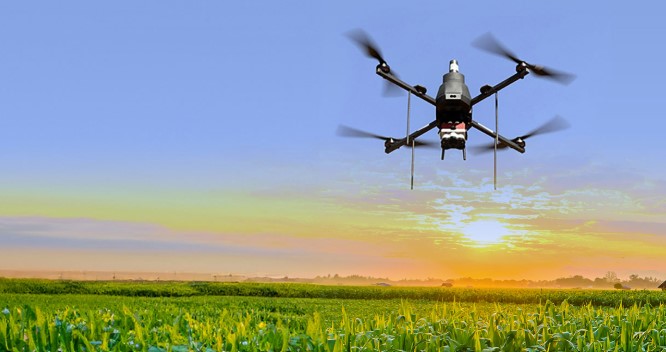
As industries across the globe embrace digital transformation, drone technology has quickly emerged as a game-changer in fields such as construction, mining, agriculture, and urban planning. However, a drone’s true power doesn’t just lie in its flight capabilities—it’s in the drone software for surveying that processes and transforms raw aerial data into actionable insights.
Whether you’re mapping vast terrains, analyzing topography, or conducting volumetric measurements, the right software is critical for precision, efficiency, and regulatory compliance. With numerous platforms available, choosing the best fit for your needs can be overwhelming. This comprehensive guide walks you through everything you need to consider when selecting drone software for surveying, while also touching on the growing relevance of the surveillance drone in data-driven security and monitoring operations.
Understanding Drone Software for Surveying
Before diving into how to choose the best tool, it’s important to understand what drone software for surveying does. When drones fly over a site and capture high-resolution images or LiDAR data, this information needs to be processed, analyzed, and visualized. Drone software handles:
Stitching images to create orthomosaic maps
Generating 2D and 3D models
Calculating distances, areas, and volumes
Creating digital elevation models (DEM) and digital terrain models (DTM)
Exporting data in GIS-compatible formats for further analysis
In short, this software converts aerial data into intelligent visualizations and measurements that enable professionals to make fast, accurate decisions.
Key Features to Look for in Drone Surveying Software
Mapping Accuracy and Georeferencing
Precision is non-negotiable in surveying. Look for software that supports real-time kinematic (RTK) and post-processed kinematic (PPK) corrections. These features improve the accuracy of coordinates, especially for large infrastructure or construction projects.
Data Processing Speed
Time is money. Efficient software should allow fast processing of raw images into useful outputs without compromising accuracy. Cloud-based platforms tend to have better processing power and scalability than local-only solutions.
Compatibility with Drone Hardware
Not all drones work seamlessly with every software. Make sure the drone software for surveying you choose supports your drone model and sensor types, including RGB, thermal, multispectral, or LiDAR.
Integration with GIS and CAD Platforms
Surveying doesn’t exist in a vacuum. You’ll often need to use the generated data in GIS or CAD software. Ensure the platform supports common export formats.SHP, DXF.LAS, .KML, or.OBJ for seamless integration with other tools in your workflow.
Ease of Use and User Interface
An intuitive user interface is especially important for field technicians and surveyors who may not have deep technical backgrounds. Look for software that offers drag-and-drop capabilities, guided workflows, and mobile compatibility.
Cloud Storage and Collaboration
Cloud-enabled platforms allow teams to upload, access, and analyze maps from anywhere. This is essential for remote collaboration, especially when stakeholders are spread across locations.
Automation and AI-Powered Analysis
The most advanced drone software for surveying includes artificial intelligence for features like automatic feature detection, terrain classification, and change detection. These smart capabilities save hours of manual analysis.
Licensing and Pricing Models
Consider whether the software is subscription-based, has a perpetual license, or charges per map/project. Choose a pricing model that aligns with your usage volume and long-term needs.
Top Use Cases of Drone Surveying Software
Modern drone software for surveying is used across a diverse range of industries. Here are some practical applications:
Construction: Site analysis, cut-and-fill calculations, and ongoing progress tracking
Agriculture: Crop health analysis, drainage planning, and soil mapping
Mining: Stockpile volumetrics, terrain modeling, and blast planning
Utilities: Infrastructure inspection, route planning, and vegetation management
Urban Planning: Land use analysis, zoning, and environmental assessments
No matter the industry, having the right software can mean the difference between costly rework and successful project delivery.
The Role of Surveillance Drones in Surveying and Beyond

While this guide focuses on surveying software, it’s impossible to ignore the rising influence of surveillance drone in related fields. Surveillance drones are increasingly being used in conjunction with survey missions to monitor large-scale construction zones, critical infrastructure, and remote assets for safety and compliance.
Security teams deploy surveillance drones with live-feed capabilities and thermal sensors to ensure site integrity and detect unauthorized activity. When integrated with smart analytics software, these drones can autonomously patrol perimeters, alert teams to anomalies, and even assist in post-incident investigations.
Surveillance drones are also becoming important in public safety and disaster response, where they assist in assessing damage, monitoring crowd movements, and mapping affected regions in real-time, highlighting their value beyond traditional security roles.
How to Evaluate and Choose the Right Solution
Choosing the ideal drone software for surveying requires a strategic evaluation based on your business goals, project types, and available budget. Here’s a quick checklist to guide your decision:
Define Your Use Case: Are you mapping for agriculture, mining, or urban development? The requirements may differ significantly.
Assess Your Team’s Skill Level: Choose software that matches the expertise of your operators and analysts.
Check Compatibility: Make sure the software works seamlessly with your drones, sensors, and data formats.
Start with a Trial: Many providers offer free trials or demo versions—use them to test functionality before committing.
Prioritize Scalability: Select a solution that can grow with your business and support future applications like AI analysis or surveillance.
By thoroughly evaluating each of these factors, you ensure your investment yields long-term value and high-performance outcomes.
Conclusion
As drone technology becomes central to digital transformation across sectors, the importance of choosing the right drone software for surveying cannot be overstated. Whether it’s capturing precise topographic data, streamlining project timelines, or enhancing site security with a surveillance drone, the software you choose will directly impact the efficiency and success of your operations.
At the forefront of this revolution is Asteria Aerospace, a leading drone and software solutions provider. With an emphasis on reliability, innovation, and regulatory compliance, Asteria offers powerful aerial mapping and analytics platforms that support a wide range of surveying and surveillance missions. Their cutting-edge systems are trusted by government bodies, infrastructure developers, and security agencies alike, making them a top choice for businesses looking to elevate their operations through intelligent aerial solutions.
In a world driven by data, let Asteria Aerospace help you see the full picture—from the skies above to the insights below.